
Where Is the Runoff Coming From? Mapping Elevation Changes Around Growing Neighborhoods
When water shows up in the wrong place after a storm, most people blame the rain and leave it there. A topographic survey tells a more useful story than that. It records the shape of the land in fine detail, so you can see how water really moves once a new subdivision goes in next door. When homes, driveways and parking lots replace open ground, the way rain drains often shifts, and that shift can land right on your lawn or against your foundation.
Ground shots, curb heights and small dips that the eye skips over all get pinned to exact elevations. That record becomes the base for figuring out why the flooding started and who might be able to fix it. The value is not a pretty map. The value is the set of hard numbers underneath it.
Reconstructing the Path Water Takes During a Storm
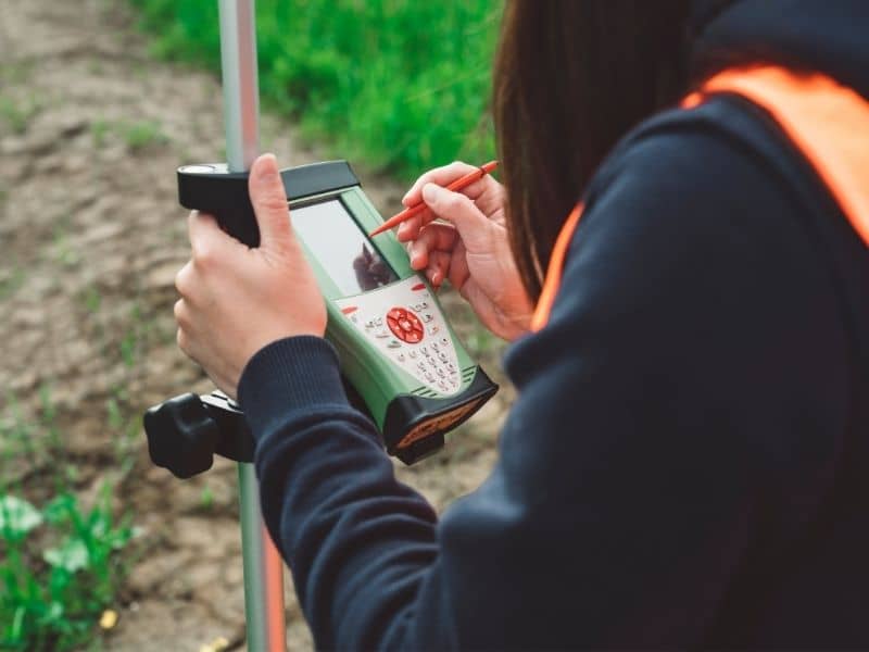
A storm leaves clues behind, and a good field crew reads them. Silt lines, matted grass and small gravel fans show where water ran fast and where it sat and pooled. The crew captures shots across the whole yard, plus the top and edge of every paved surface, so the drop from one point to the next becomes a real measurement instead of a guess.
Curbs and swales matter here too. A curb steers water along a street until it finds a low spot, and a shallow swale can carry a surprising amount of flow during heavy rain. By tying each of these to one shared elevation, the survey rebuilds the route water took, foot by foot, from the high side of the block down to wherever it left your property.
Separating Natural Low Areas From Development-Created Changes
Not every wet spot is new. Some yards have always held water in one corner because that is simply where the ground sits lowest. The trick is telling an old, natural dip apart from a change that recent building created, and careful elevation data does that job well.
When a builder brings in fill, raises a pad or pours a wide driveway, the finished grade often ends up higher than the land around it. That new high ground pushes water sideways instead of letting it soak in or run straight off. A survey shows the difference in plain numbers, so a raised lot or a fresh wall stops being a matter of opinion and turns into something you can point to on a drawing. That shift from feeling to fact is what makes the whole effort worthwhile.
Locating the Point Where Runoff Crosses a Property
Water rarely spreads evenly along a line. More often it gathers and pours through one narrow gap, and that concentrated point does the most damage. Finding it matters, because a fix aimed at the wrong place wastes money and solves nothing. The crew hunts for the exact spots where flow gets funneled.
The features worth pinning down usually include:
● Culvert openings and the end of any drainage pipe
● Low gaps in a fence line, curb or wall where water slips through
● The precise spot where one yard drains onto the next
With those points fixed to real elevations, an engineer can measure how much slope feeds each one and plan around the true entry point rather than a rough guess. One well-placed catch basin at the right spot often beats a whole yard of regrading done blind.
Comparing Finished Grades With the Surrounding Neighborhood
Measuring only the soggy corner tells you almost nothing. Drainage problems come from the way properties sit against each other, so the survey has to look wider than the single wet spot. Shots taken across several lots give context that one yard alone can never supply.
When you can see how your grade sits against the homes uphill and the street below, patterns show up fast. Maybe three lots all tilt toward one back corner. Maybe a new house sits a full foot above everything near it. That kind of side-by-side comparison turns a private complaint into a clear picture of how the whole block sheds water, and it points straight at the source.
Turning Field Measurements Into Useful Engineering Evidence
Raw shots on their own fix nothing. Their worth appears once they are built into a surface model, a digital version of the ground that an engineer can study and test. From that model, someone can try a regrade, a new swale or a small drainage structure and see on screen whether it would move water away from the house before a single shovel touches dirt.
A survey also gives the numbers real weight if the trouble ever reaches a lawyer or a public office. Measured elevations, taken by a licensed crew, carry more authority than photos or memory. They let the people responsible for a decision work from facts instead of hunches, and that often shortens the road to an actual repair.
Frequently Asked Questions
Can a topographic survey identify where neighborhood runoff enters my property?
Yes. By recording elevations across your lot and the land nearby, the survey shows the low points and flow paths where water crosses onto your ground. The result marks those entry points clearly, which helps an engineer aim a fix at the right spot instead of guessing.
Should adjoining lots be included when investigating a drainage complaint?
In most cases they should. Water moves between properties, so measuring only your yard leaves out half the story. Shots from neighboring lots reveal how the grades line up and where uphill changes may be sending extra flow your way.
Can the survey show whether a retaining wall altered the original water path?
It can point strongly toward an answer. By capturing grades on both sides of the wall and comparing them with the land around it, the survey shows whether the structure now blocks, holds or redirects water that once drained a different way.
