↓
 

Oxford Land Surveying

Land Surveyors in Oxford, Alabama

Oxford Land Surveying
  • Home
  • ALTA Survey
  • Boundary Survey – Property Survey
  • Civil Engineering
  • Construction Survey
  • Drone LiDAR Mapping
  • Elevation Certificate
  • Land Surveying
  • Topographic Survey | Topo Survey
  • Contact Us
  • Blog
Home 1 2 3 … 7 8 >>

Post navigation

← Older posts

Welcome to Oxford Land Surveying

Oxford Land Surveying Posted on August 9, 2010 by OxfordLSJanuary 9, 2018

Oxford Land Surveying

Oxford Land SurveyingThis site is intended to provide you with information on Land Surveying in the Oxford & Anniston, AL and Calhoun County area of Alabama . If you’re looking for an Oxford Land Surveyor, you’ve come to the right site.

If you’d rather talk to someone about your land surveying needs, please call  256-733-1733 today. For more information, please continue to read.

Land Surveyors are professionals who measure and make precise measurements to determine the size and boundaries of a piece of real estate.  While this is a simplistic definition, boundary surveying is one of the most common types of surveying related to home and land-owners. If you fall into one of the following categories, please click on the appropriate link for more information on that subject:

  • I need to know where my property corners or property lines are. (Boundary Survey)
  • I have a loan closing or re-finance coming up on my home in a subdivision. (Lot Survey)
  • I need a map of my property with contour lines to show elevation differences for my architect or engineer. (Topo Survey)
  • I’ve just been told I’m in a flood zone or I ‘ve been told I need an elevation certificate in order to obtain flood insurance or prove I don’t need it. (Elevation Certificate)
  • I’m purchasing a lot/house in a recorded subdivision. (Lot Survey – See Boundary Survey)
  • I’m purchasing a larger tract of land, acreage, that hasn’t been subdivided in the past. (Boundary Survey)
  • I need to get some location and grades set on a construction project. (Construction Survey )
  • I need a survey of a commercial or multi-family site that meets the ALTA Land Title Survey requirements. (ALTA Survey)

If your needs don’t fall into one of the above, don’t worry, we’ll get to the bottom of it. CALL Oxford Land Surveying TODAY at 256-733-1733 OR better yet, fill out a Contact Form request to discuss your survey needs.

Posted in land surveying, land surveyor | Tagged boundary survey, Land Surveying, land surveying oxford, land surveyor, land surveyor oxford, Oxford land surveying

Where Is the Runoff Coming From? Mapping Elevation Changes Around Growing Neighborhoods

Oxford Land Surveying Posted on July 16, 2026 by OxfordLSJuly 16, 2026
Surveyor using a GPS data collector and survey rover to record precise ground elevation measurements for topographic mapping.

When water shows up in the wrong place after a storm, most people blame the rain and leave it there. A topographic survey tells a more useful story than that. It records the shape of the land in fine detail, so you can see how water really moves once a new subdivision goes in next door. When homes, driveways and parking lots replace open ground, the way rain drains often shifts, and that shift can land right on your lawn or against your foundation.

Ground shots, curb heights and small dips that the eye skips over all get pinned to exact elevations. That record becomes the base for figuring out why the flooding started and who might be able to fix it. The value is not a pretty map. The value is the set of hard numbers underneath it.

Reconstructing the Path Water Takes During a Storm

A storm leaves clues behind, and a good field crew reads them. Silt lines, matted grass and small gravel fans show where water ran fast and where it sat and pooled. The crew captures shots across the whole yard, plus the top and edge of every paved surface, so the drop from one point to the next becomes a real measurement instead of a guess.

Curbs and swales matter here too. A curb steers water along a street until it finds a low spot, and a shallow swale can carry a surprising amount of flow during heavy rain. By tying each of these to one shared elevation, the survey rebuilds the route water took, foot by foot, from the high side of the block down to wherever it left your property.

Separating Natural Low Areas From Development-Created Changes

Not every wet spot is new. Some yards have always held water in one corner because that is simply where the ground sits lowest. The trick is telling an old, natural dip apart from a change that recent building created, and careful elevation data does that job well.

When a builder brings in fill, raises a pad or pours a wide driveway, the finished grade often ends up higher than the land around it. That new high ground pushes water sideways instead of letting it soak in or run straight off. A survey shows the difference in plain numbers, so a raised lot or a fresh wall stops being a matter of opinion and turns into something you can point to on a drawing. That shift from feeling to fact is what makes the whole effort worthwhile.

Locating the Point Where Runoff Crosses a Property

Water rarely spreads evenly along a line. More often it gathers and pours through one narrow gap, and that concentrated point does the most damage. Finding it matters, because a fix aimed at the wrong place wastes money and solves nothing. The crew hunts for the exact spots where flow gets funneled.

The features worth pinning down usually include:

●        Culvert openings and the end of any drainage pipe

●        Low gaps in a fence line, curb or wall where water slips through

●        The precise spot where one yard drains onto the next

With those points fixed to real elevations, an engineer can measure how much slope feeds each one and plan around the true entry point rather than a rough guess. One well-placed catch basin at the right spot often beats a whole yard of regrading done blind.

Comparing Finished Grades With the Surrounding Neighborhood

Measuring only the soggy corner tells you almost nothing. Drainage problems come from the way properties sit against each other, so the survey has to look wider than the single wet spot. Shots taken across several lots give context that one yard alone can never supply.

When you can see how your grade sits against the homes uphill and the street below, patterns show up fast. Maybe three lots all tilt toward one back corner. Maybe a new house sits a full foot above everything near it. That kind of side-by-side comparison turns a private complaint into a clear picture of how the whole block sheds water, and it points straight at the source.

Turning Field Measurements Into Useful Engineering Evidence

Raw shots on their own fix nothing. Their worth appears once they are built into a surface model, a digital version of the ground that an engineer can study and test. From that model, someone can try a regrade, a new swale or a small drainage structure and see on screen whether it would move water away from the house before a single shovel touches dirt.

A survey also gives the numbers real weight if the trouble ever reaches a lawyer or a public office. Measured elevations, taken by a licensed crew, carry more authority than photos or memory. They let the people responsible for a decision work from facts instead of hunches, and that often shortens the road to an actual repair.

Frequently Asked Questions

Can a topographic survey identify where neighborhood runoff enters my property?

Yes. By recording elevations across your lot and the land nearby, the survey shows the low points and flow paths where water crosses onto your ground. The result marks those entry points clearly, which helps an engineer aim a fix at the right spot instead of guessing.

Should adjoining lots be included when investigating a drainage complaint?

In most cases they should. Water moves between properties, so measuring only your yard leaves out half the story. Shots from neighboring lots reveal how the grades line up and where uphill changes may be sending extra flow your way.

Can the survey show whether a retaining wall altered the original water path?

It can point strongly toward an answer. By capturing grades on both sides of the wall and comparing them with the land around it, the survey shows whether the structure now blocks, holds or redirects water that once drained a different way.

Posted in topographic survey | Tagged topographic survey

How LiDAR Mapping Helps Identify Flood-Prone Areas Before Development Begins

Oxford Land Surveying Posted on June 22, 2026 by OxfordLSJuly 16, 2026
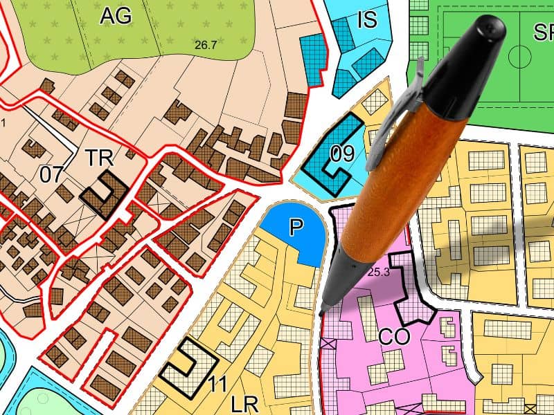
Land use map used during predevelopment planning to evaluate terrain and identify areas with potential flood risk

A flood inspection usually happens after something has already gone wrong. Water got into a foundation, a road washed out, or an insurance adjuster showed up to assess damage. LiDAR mapping flips that order. It lets developers and property owners spot flood risk on a parcel before a single shovel hits the ground. The land is still just lines on a survey, and decisions are still cheap to change.

That timing matters more than most people realize. Once roads are paved and foundations are poured, fixing a drainage mistake means tearing something up. Catching the same problem early means moving a building pad a few feet. It can mean routing a road around a low spot instead of through it.

Why Flood Risks Are Not Always Visible During a Property Walk

A piece of land can look perfectly dry and level on a sunny afternoon and still flood every spring. That contradiction trips up a lot of buyers and builders. They walk a site once, like what they see, and move forward without realizing how little a walk-through actually tells them.

The eye is bad at judging slope. A grade change of a foot or two across a few hundred feet feels invisible when you’re standing on it. Yet that small change is enough to send water in a completely different direction during a storm. Add in tall grass, scattered brush, or a dry season, and shallow depressions disappear from view entirely. They’re still there. They just aren’t holding water the day someone happens to be looking.

This is why so many flood problems on undeveloped land get discovered the hard way. A builder assumes a site is flat because it looks flat. A buyer skips a deeper terrain study because the property “seemed fine” during a tour. Then the first real storm hits, and water shows up exactly where nobody expected it. It was never actually flat to begin with.

How LiDAR Mapping Creates High-Resolution Terrain Models for Site Evaluation

LiDAR mapping solves this by replacing guesswork with measurement. A plane or drone equipped with a laser scanner flies over the property and fires millions of pulses at the ground. Each pulse bounces back at a slightly different time, depending on what it hits, and that timing becomes a precise elevation point. Stack enough of these points together and you get a surface model that can show changes of just a few inches across an entire parcel.

That level of detail is what makes the technology so useful before construction begins. Depressions that never show up on a standard survey suddenly stand out clearly on the model. So do ridges, saddle points, and natural drainage corridors. These features have been quietly shaping how water moves across the land for decades. None of this requires walking the property in the right season or getting lucky enough to see it rain.

Engineers and planners use this model to ask specific questions before anything gets built. Where does water enter the site?. Where does it pool?. Where does it eventually leave?. Those answers used to take a lot of educated guessing. Now they come straight from the data.

Identifying Seasonal Overflow Areas Before Roads and Foundations Are Designed

Not every flood risk is a permanent feature of the land. Plenty of properties have areas that stay dry most of the year. They only fill with water after a heavy rain or during spring thaw. These seasonal overflow zones are some of the trickiest hazards to catch on a standard site visit. They look like ordinary ground most months of the year.

LiDAR mapping catches these areas regardless of season, because it’s reading elevation, not surface conditions. A shallow basin that floods every March looks exactly the same on the terrain model whether the flight happens in July or January. That consistency lets planners identify temporary water zones with the same confidence as permanent ones. Nobody has to hope a site visit lands during the right week of the year.

Knowing where these zones sit changes real decisions. A building pad shifted thirty feet can avoid a seasonal low spot entirely. An access road routed along higher ground stays usable in March instead of turning into a muddy mess every spring. None of these adjustments are expensive when they happen on paper. They get expensive fast once concrete is already in the ground.

Using LiDAR Data to Support Smarter Stormwater Management Strategies

Once a site’s flood risks are mapped, the next question is what to do about them. This is where LiDAR data earns its keep for engineers designing stormwater systems. Detention ponds, drainage channels, and culverts all need accurate sizing. A rough estimate based on general slope isn’t enough.

A few specific things planners typically work out using this data:

  • Where a detention pond can be placed to capture runoff without disrupting other site features
  • How large a culvert needs to be, based on real watershed boundaries rather than guesswork
  • Which areas of the site need regrading to redirect water away from planned structures

This kind of planning is different from flood repair. Repair happens after a system fails, usually during or right after a storm. It tends to cost far more than doing the work right the first time. Designing stormwater infrastructure around accurate terrain data, before construction begins, means the system gets sized correctly from day one. Nobody has to patch and resize it a few years down the road.

Evaluating Large Parcels for Future Development Opportunities

For anyone evaluating farmland, a commercial tract, a future subdivision, or recreational property, LiDAR mapping offers something a basic survey can’t. It gives a complete picture of how usable the land actually is. Large parcels often contain a mix of solid, buildable ground and sections that will fight a developer every step of the way.

Understanding exactly where those flood-prone sections sit changes how owners think about the property. A hundred-acre tract might have eighty usable acres and twenty that should stay open space or pasture. Knowing that breakdown before purchase, or before drafting a site plan, lets owners price the land accurately. It helps them design around its limits instead of discovering them mid-project, and avoids the surprise of platting lots in areas that hold water every spring.

This kind of clarity pays off most on land that looks uniform at first glance. Farmland and recreational tracts often span hundreds of acres with no dramatic features anywhere. That makes them exactly the kind of property where subtle elevation problems hide easiest. A detailed terrain model turns that uncertainty into a clear map of what works and what doesn’t.

Frequently Asked Questions

How does LiDAR mapping help identify flood-prone areas? 

LiDAR mapping creates detailed elevation models that reveal low spots and natural drainage patterns where water is likely to collect.

Can LiDAR mapping detect areas that are not shown on flood maps? 

Yes. LiDAR data can uncover subtle terrain features and localized drainage issues that may not appear on broad flood zone maps.

Who benefits from LiDAR mapping before development begins? 

Developers, builders, commercial property owners, land buyers, engineers, and homeowners can all benefit from understanding site conditions before construction.

Posted in LiDAR Mapping | Tagged LiDAR Mapping

When Is an Elevation Certificate Required?

Oxford Land Surveying Posted on May 29, 2026 by OxfordLSJune 5, 2026
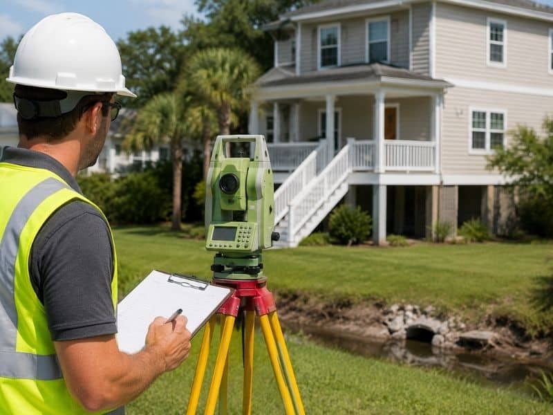
Licensed land surveyor inspecting a residential property and collecting elevation data for an elevation certificate assessment

You find a home that looks perfect. The price is right, the location feels great, and the property checks all your boxes. Then someone asks, “Do you have an elevation certificate?” Suddenly, a document you may have never heard of becomes important.

Many property owners do not think about elevation certificates until they run into flood insurance questions, permit requirements, or construction plans. By that point, delays can happen if the information is not available.

If you own property, plan to buy land, or are preparing for construction, understanding when an elevation certificate is needed can save time and help avoid surprises.

What Is an Elevation Certificate?

An elevation certificate is a document that records a building’s elevation compared to flood levels shown on FEMA flood maps. It helps determine flood risk and supports insurance and floodplain requirements.

This document is usually completed by a licensed land surveyor, engineer, or architect. It includes measurements and details about the structure and property location.

An elevation certificate often contains:

  • Lowest floor elevation
  • Flood zone information
  • Base Flood Elevation data
  • Building location details
  • FEMA map information
  • Photos of the structure
  • Professional certification

The information helps insurance companies, lenders, and local officials better understand the property’s flood risk.

When Do You Need an Elevation Certificate?

You may need an elevation certificate when buying property in a flood area, applying for flood insurance, or planning work on a structure in a floodplain.

Not every property requires one. However, several situations commonly lead to the need for this document.

Buying Property Near Flood Zones

Many buyers focus on home inspections and financing, but flood risk can create unexpected costs. If a property sits in or near a flood hazard area, lenders or insurance companies may request elevation information.

Having an elevation certificate early can help buyers understand potential insurance costs before closing.

This becomes especially useful for properties near streams, creeks, or low-lying areas around Oxford and nearby communities.

Applying for Flood Insurance

Flood insurance companies often use elevation information to understand a property’s level of risk.

A building that sits above expected flood levels may qualify for different insurance considerations compared to a structure that sits lower.

An elevation certificate provides measurements that help support these decisions.

Some homeowners discover that having updated elevation information prevents confusion during the insurance process.

Building or Improving a Structure

Oxford follows floodplain management rules for construction in certain areas. If you plan to build a new structure or make major improvements, elevation records may be required during permitting.

Projects may include:

  • New homes
  • Additions
  • Garages
  • Major renovations
  • Building improvements
  • Certain site development projects

If the work affects structures inside regulated flood areas, elevation documentation can become part of the permit process.

Planning early can help prevent delays after construction begins.

What Information Does a Surveyor Collect?

Many people assume an elevation certificate only measures height. In reality, several pieces of information are gathered.

During the process, survey professionals may document:

  • Ground elevation around the structure
  • Lowest finished floor level
  • Building characteristics
  • Flood map information
  • Utility details
  • Photographs
  • Geographic location data

Accurate measurements matter because even small differences can affect flood-related decisions.

Professional equipment helps ensure the information is recorded correctly.

Can an Older Elevation Certificate Still Be Used?

Sometimes yes, but not always.

Older certificates may still be acceptable if no major property changes have occurred and local requirements remain the same. However, several things can affect whether an older document is useful:

  • Building additions
  • Renovations
  • Updated FEMA mapping
  • Site grading changes
  • Floodplain updates

Property owners sometimes assume an older certificate will always work, only to learn updated information is needed later.

If there is uncertainty, checking before starting a project can prevent extra work.

Why Waiting Can Create Problems

Many people do not realize they need an elevation certificate until they are already under deadlines.

A buyer may be close to closing. A contractor may already be scheduled. Insurance paperwork may already be underway.

At that point, everyone is waiting on elevation information.

Getting answers early helps avoid last-minute stress. It also gives property owners time to understand how flood requirements may affect future plans.

For owners planning projects, preparation often makes the process much easier.

Frequently Asked Questions

Who can prepare an elevation certificate?

A licensed land surveyor, engineer, or architect may prepare an elevation certificate depending on state requirements.

Does every home need an elevation certificate?

No. Many properties never need one. Requirements often depend on flood zones, insurance needs, and construction activity.

Can an elevation certificate reduce flood insurance costs?

In some cases, elevation information may help support more accurate flood risk assessments.

How long does it take to complete an elevation certificate?

Timing varies depending on property conditions, project demand, and scheduling availability.

Is an elevation certificate the same as a land survey?

No. An elevation certificate focuses on flood-related elevation information, while land surveys may address boundaries, improvements, or other property details.

Posted in land surveying | Tagged elevation certificate, flood elevation survey

Post navigation

← Older posts
Get Quote Button
© Copyright Boxer Survey USA
OxfordLandSurveying.com
Oxford, Alabama
Phone: (256) 733-1733

Privacy Policy | Terms of Use

Web Development and SEO by:
AuburnBusiness.com, LLC

The owner of this website, Boxer Survey USA, provides coordination of professional land surveying and engineering services in all 50 states. The professional surveying and engineering services provided to you will be conducted by fully licensed professionals in your state.

↑