↓
 

Oxford Land Surveying

Land Surveyors in Oxford, Alabama

Oxford Land Surveying
  • Home
  • ALTA Survey
  • Boundary Survey – Property Survey
  • Civil Engineering
  • Construction Survey
  • Drone LiDAR Mapping
  • Elevation Certificate
  • Land Surveying
  • Topographic Survey | Topo Survey
  • Contact Us
  • Blog
Home 1 2 3 … 6 7 >>

Post navigation

← Older posts

Welcome to Oxford Land Surveying

Oxford Land Surveying Posted on August 9, 2010 by OxfordLSJanuary 9, 2018

Oxford Land Surveying

Oxford Land SurveyingThis site is intended to provide you with information on Land Surveying in the Oxford & Anniston, AL and Calhoun County area of Alabama . If you’re looking for an Oxford Land Surveyor, you’ve come to the right site.

If you’d rather talk to someone about your land surveying needs, please call  256-733-1733 today. For more information, please continue to read.

Land Surveyors are professionals who measure and make precise measurements to determine the size and boundaries of a piece of real estate.  While this is a simplistic definition, boundary surveying is one of the most common types of surveying related to home and land-owners. If you fall into one of the following categories, please click on the appropriate link for more information on that subject:

  • I need to know where my property corners or property lines are. (Boundary Survey)
  • I have a loan closing or re-finance coming up on my home in a subdivision. (Lot Survey)
  • I need a map of my property with contour lines to show elevation differences for my architect or engineer. (Topo Survey)
  • I’ve just been told I’m in a flood zone or I ‘ve been told I need an elevation certificate in order to obtain flood insurance or prove I don’t need it. (Elevation Certificate)
  • I’m purchasing a lot/house in a recorded subdivision. (Lot Survey – See Boundary Survey)
  • I’m purchasing a larger tract of land, acreage, that hasn’t been subdivided in the past. (Boundary Survey)
  • I need to get some location and grades set on a construction project. (Construction Survey )
  • I need a survey of a commercial or multi-family site that meets the ALTA Land Title Survey requirements. (ALTA Survey)

If your needs don’t fall into one of the above, don’t worry, we’ll get to the bottom of it. CALL Oxford Land Surveying TODAY at 256-733-1733 OR better yet, fill out a Contact Form request to discuss your survey needs.

Posted in land surveying, land surveyor | Tagged boundary survey, Land Surveying, land surveying oxford, land surveyor, land surveyor oxford, Oxford land surveying

When Is an Elevation Certificate Required?

Oxford Land Surveying Posted on May 29, 2026 by OxfordLSJune 5, 2026
Licensed land surveyor inspecting a residential property and collecting elevation data for an elevation certificate assessment

You find a home that looks perfect. The price is right, the location feels great, and the property checks all your boxes. Then someone asks, “Do you have an elevation certificate?” Suddenly, a document you may have never heard of becomes important.

Many property owners do not think about elevation certificates until they run into flood insurance questions, permit requirements, or construction plans. By that point, delays can happen if the information is not available.

If you own property, plan to buy land, or are preparing for construction, understanding when an elevation certificate is needed can save time and help avoid surprises.

What Is an Elevation Certificate?

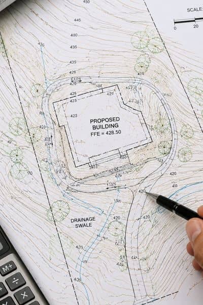
An elevation certificate is a document that records a building’s elevation compared to flood levels shown on FEMA flood maps. It helps determine flood risk and supports insurance and floodplain requirements.

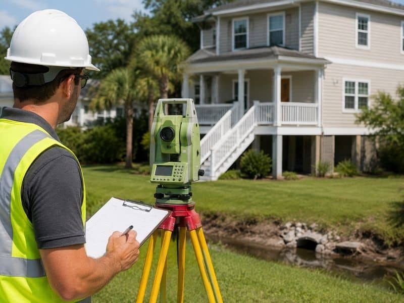
This document is usually completed by a licensed land surveyor, engineer, or architect. It includes measurements and details about the structure and property location.

An elevation certificate often contains:

  • Lowest floor elevation
  • Flood zone information
  • Base Flood Elevation data
  • Building location details
  • FEMA map information
  • Photos of the structure
  • Professional certification

The information helps insurance companies, lenders, and local officials better understand the property’s flood risk.

When Do You Need an Elevation Certificate?

You may need an elevation certificate when buying property in a flood area, applying for flood insurance, or planning work on a structure in a floodplain.

Not every property requires one. However, several situations commonly lead to the need for this document.

Buying Property Near Flood Zones

Many buyers focus on home inspections and financing, but flood risk can create unexpected costs. If a property sits in or near a flood hazard area, lenders or insurance companies may request elevation information.

Having an elevation certificate early can help buyers understand potential insurance costs before closing.

This becomes especially useful for properties near streams, creeks, or low-lying areas around Oxford and nearby communities.

Applying for Flood Insurance

Flood insurance companies often use elevation information to understand a property’s level of risk.

A building that sits above expected flood levels may qualify for different insurance considerations compared to a structure that sits lower.

An elevation certificate provides measurements that help support these decisions.

Some homeowners discover that having updated elevation information prevents confusion during the insurance process.

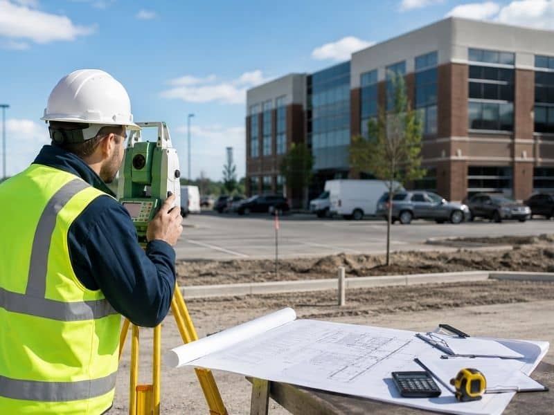
Building or Improving a Structure

Oxford follows floodplain management rules for construction in certain areas. If you plan to build a new structure or make major improvements, elevation records may be required during permitting.

Projects may include:

  • New homes
  • Additions
  • Garages
  • Major renovations
  • Building improvements
  • Certain site development projects

If the work affects structures inside regulated flood areas, elevation documentation can become part of the permit process.

Planning early can help prevent delays after construction begins.

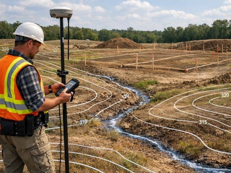
What Information Does a Surveyor Collect?

Many people assume an elevation certificate only measures height. In reality, several pieces of information are gathered.

During the process, survey professionals may document:

  • Ground elevation around the structure
  • Lowest finished floor level
  • Building characteristics
  • Flood map information
  • Utility details
  • Photographs
  • Geographic location data

Accurate measurements matter because even small differences can affect flood-related decisions.

Professional equipment helps ensure the information is recorded correctly.

Can an Older Elevation Certificate Still Be Used?

Sometimes yes, but not always.

Older certificates may still be acceptable if no major property changes have occurred and local requirements remain the same. However, several things can affect whether an older document is useful:

  • Building additions
  • Renovations
  • Updated FEMA mapping
  • Site grading changes
  • Floodplain updates

Property owners sometimes assume an older certificate will always work, only to learn updated information is needed later.

If there is uncertainty, checking before starting a project can prevent extra work.

Why Waiting Can Create Problems

Many people do not realize they need an elevation certificate until they are already under deadlines.

A buyer may be close to closing. A contractor may already be scheduled. Insurance paperwork may already be underway.

At that point, everyone is waiting on elevation information.

Getting answers early helps avoid last-minute stress. It also gives property owners time to understand how flood requirements may affect future plans.

For owners planning projects, preparation often makes the process much easier.

Frequently Asked Questions

Who can prepare an elevation certificate?

A licensed land surveyor, engineer, or architect may prepare an elevation certificate depending on state requirements.

Does every home need an elevation certificate?

No. Many properties never need one. Requirements often depend on flood zones, insurance needs, and construction activity.

Can an elevation certificate reduce flood insurance costs?

In some cases, elevation information may help support more accurate flood risk assessments.

How long does it take to complete an elevation certificate?

Timing varies depending on property conditions, project demand, and scheduling availability.

Is an elevation certificate the same as a land survey?

No. An elevation certificate focuses on flood-related elevation information, while land surveys may address boundaries, improvements, or other property details.

Posted in land surveying | Tagged elevation certificate, flood elevation survey

Why a Topographic Survey Matters 

Oxford Land Surveying Posted on May 27, 2026 by OxfordLSJune 5, 2026
Surveyor using GPS equipment on a construction site with contour lines and elevation changes to support topographic survey planning

Imagine buying land, hiring a designer, and getting excited about a future project, only to discover later that the property slopes toward a drainage area or has elevation changes nobody noticed. That kind of surprise can lead to redesign costs, delays, and construction problems.

Many people focus on the building itself and forget one important step. Before any design work begins, the land needs to be understood first. That is where a topographic survey becomes valuable.

A topographic survey provides a detailed picture of the property’s surface conditions. It helps architects, engineers, and property owners understand how the land behaves before creating plans.

What Is a Topographic Survey?

A topographic survey is a detailed map that records both natural and man-made features on a property. It shows how the land rises, falls, and changes across the site.

Unlike surveys that focus mainly on property boundaries, a topographic survey gathers information about the shape and condition of the land itself.

Common items shown on a topographic survey include:

  • Ground elevations
  • Slopes and contours
  • Trees and landscaping features
  • Buildings and structures
  • Sidewalks and driveways
  • Drainage areas
  • Utility features visible above ground
  • Fences and retaining walls

Surveyors collect measurements in the field using advanced equipment and software. The finished survey becomes a working guide for design professionals before planning starts.

Why Is a Topographic Survey Needed Before Site Design?

A topographic survey is often one of the first steps before creating site plans because land conditions directly affect the design process.

A property may appear flat when viewed from the road. Once measurements are collected, small elevation changes may reveal drainage concerns or construction challenges.

Design teams rely on this information to make informed decisions early.

A topographic survey helps:

  • Determine proper building placement
  • Support grading plans
  • Identify drainage patterns
  • Plan driveways and access routes
  • Reduce design revisions
  • Improve permit submissions

Without accurate site information, design decisions can become educated guesses. Guesswork usually creates problems later.

Understanding Contour Lines and Elevation Data

Digital topographic survey map showing contour lines, elevation changes, and terrain data used for site planning and land development

One of the most important parts of a topographic survey is the use of contour lines.

Contour lines connect areas that share the same elevation. They help create a visual picture of how the land changes from one point to another.

According to the United States Geological Survey, contour lines are a standard method used to represent land shape and elevation on maps. Closely spaced contour lines usually indicate steeper ground, while wider spacing suggests flatter terrain.

These details may seem small, but they play a major role during planning.

For example, a steep section of land could affect:

  • Foundation design
  • Water runoff direction
  • Drainage systems
  • Vehicle access
  • Landscaping layouts

Understanding elevation early can prevent expensive corrections later.

Who Uses Topographic Surveys?

Many people assume topographic surveys are only for large developments. In reality, they are useful for projects of many sizes.

Professionals who commonly use them include:

Architects

Architects use site information to design structures that fit the property’s shape and conditions.

Engineers

Engineers rely on elevation data when planning grading, drainage, and infrastructure improvements.

Developers

Developers often need a complete understanding of the land before evaluating project feasibility.

Property Owners

Homeowners planning additions, detached buildings, or major outdoor projects may also benefit from topographic information.

The larger or more complex the property becomes, the more valuable accurate land data can be.

What Can Happen Without a Topographic Survey?

Skipping early site analysis may save time at first, but problems often appear later.

Construction crews sometimes discover unexpected elevation changes after plans are already complete. When this happens, design modifications may be needed.

Potential issues can include:

  • Drainage problems
  • Standing water around structures
  • Unexpected grading costs
  • Poor driveway slopes
  • Permit delays
  • Construction adjustments

Fixing problems during construction is often more expensive than identifying them before design begins.

Good planning starts with reliable information.

When Should You Order a Topographic Survey?

A topographic survey works best when completed early in the planning process.

Property owners often order one before:

  • Designing a new structure
  • Planning land improvements
  • Preparing development plans
  • Creating drainage solutions
  • Designing parking areas
  • Starting larger construction projects

Waiting too long can create delays if designers must stop work and request additional field information.

Starting with accurate site data helps projects move forward with fewer surprises.

Posted in land surveying | Tagged topographic survey

Buying Property? Here’s When an ALTA Survey Is Needed 

Oxford Land Surveying Posted on May 25, 2026 by OxfordLSJune 5, 2026
Surveyor reviewing plans at a commercial property site with buildings and mapped property details during an ALTA survey process

Buying commercial property is a big decision. Before money changes hands, buyers want to know exactly what they are getting. A property may look fine at first, but hidden issues can create problems later. There could be access concerns, utility easements, or structures crossing property lines.

This is where an ALTA Survey becomes useful.

An ALTA Survey gives buyers, lenders, title companies, and developers a clear look at a property before important decisions are made. It combines property measurements with legal records to help uncover issues early.

What Is an ALTA Survey?

An ALTA Survey is a detailed land survey used mostly in commercial real estate deals. It follows standards created by the American Land Title Association and the National Society of Professional Surveyors.

Unlike a basic survey, an ALTA Survey does more than show property lines. It compares what exists on the land with legal property records.

This type of survey is often used for:

  • Commercial property purchases
  • Property refinancing
  • New development projects
  • Shopping centers
  • Office buildings
  • Industrial properties
  • Large land purchases

Banks and title companies often ask for an ALTA Survey before approving loans or issuing title insurance.

What Does an ALTA Survey Show?

An ALTA Survey gives a detailed picture of a property. It helps identify features and conditions that may affect ownership or future plans.

An ALTA Survey may show:

  • Property boundaries
  • Buildings and structures
  • Driveways and access points
  • Easements
  • Rights-of-way
  • Fences
  • Utility features
  • Parking areas
  • Roads
  • Encroachments

Surveyors compare field measurements with title records. This process can uncover problems before a property sale is completed.

When Do You Need an ALTA Survey?

Many people ask for an ALTA Survey during commercial property transactions. Different surveys serve different purposes. An ALTA Survey provides more information than a simple property line survey.

You may need an ALTA Survey if you are:

  • Buying commercial property
  • Selling commercial property
  • Refinancing property
  • Working with a lender
  • Planning future development
  • Purchasing large land parcels
  • Applying for title insurance

For example, a developer buying land for a future shopping center may need to confirm access rights and utility locations before construction starts.

Finding these details early can help avoid delays later.

Who Requests an ALTA Survey?

Several groups may ask for an ALTA Survey because they rely on the information it provides.

Common examples include:

  • Banks
  • Lenders
  • Title companies
  • Commercial property buyers
  • Developers
  • Investors
  • Attorneys

Lenders use ALTA Surveys to reduce risk. Title companies review the survey to help support title insurance coverage. Buyers use the information to better understand the property.

What Documents Help Start an ALTA Survey?

Surveyors can begin with basic property information, but certain documents help speed up the process.

Helpful documents include:

  • Title commitments
  • Property deeds
  • Legal descriptions
  • Existing surveys
  • Easement documents
  • Recorded plats

One of the most important documents is the title commitment. It helps surveyors identify recorded items connected to the property.

Missing records can sometimes slow down the process.

What Are Table A Items?

ALTA Surveys include optional items called Table A items.

These are extra details requested by the buyer, lender, or title company. Different projects require different information.

Common Table A items include:

  • Flood zone information
  • Utility details
  • Parking counts
  • Building measurements
  • Exterior site features
  • Zoning-related information

Not every project needs every option. The selected items usually depend on the goals of the project.

Why Is an ALTA Survey Important Before Closing?

Property problems found after a sale can become expensive.

An ALTA Survey helps identify issues before the closing process is complete.

For example, it may reveal:

  • A fence crossing onto another property
  • Access rights that are different than expected
  • Utility easements affecting future plans
  • Structures built in the wrong location

Finding these issues early gives buyers time to ask questions and solve problems before moving forward.

ALTA standards are also updated over time. Surveyors follow national standards to help provide consistent information across projects.

Frequently Asked Questions

Is an ALTA Survey the same as a boundary survey?

No. A boundary survey mainly identifies property lines. An ALTA Survey includes additional details such as title records, easements, and site improvements.

How long does an ALTA Survey take?

The timeline depends on the size of the property and available records. Larger sites often take more time.

Are ALTA Surveys only used for commercial properties?

Most ALTA Surveys are used for commercial transactions, but some larger properties may also require them.

Can an ALTA Survey uncover property issues?

Yes. It can identify encroachments, access concerns, easements, and other issues that affect a property.

Do all ALTA Surveys include Table A items?

No. Table A items are optional and depend on the needs of the project.

Posted in alta survey | Tagged alta survey

Post navigation

← Older posts
Get Quote Button
© Copyright Oxford Land Surveying
Oxford, Alabama
Phone: (256) 733-1733

Privacy Policy | Terms of Use

Web Development and SEO by:
SEO Company for Professionals

The owner of this website, USA Surveying & Engineering, LLC., provides coordination of professional land surveying and engineering services in all 50 states. The professional surveying and engineering services provided to you will be conducted by fully licensed professionals in your state.

↑